Truro Maps and Orientation
(Truro, Cornwall, England, UK)
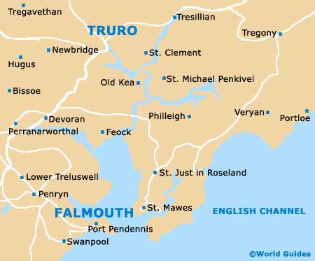
Sited within the district of Carrick, Truro stands towards the far western side of Cornwall, being sandwiched between Falmouth and St. Austell. Truro is located in the south-western area of England and lies slightly inland, and was once a thriving market town with a particularly busy port. Over the years, Truro has suffered a number of winter floods and as a result, substantial flood defences are now in place to protect the city from any further occurrences.
Maps and Orientation of the City
Truro is well connected to the surrounding area by a series of major roads, which include the A30, the A39, and also the A390, which passes St. Austell, St. Blazey, Lostwithiel and Liskeard to the north-east. Just a short drive to Cornwall's stunning south coastline, Truro stands directly south of
Newquay, and the northern shore is also within easy driving distance.
The list below shows the most prominent towns and villages in close proximity to Truro, complete with distances and approximate journey times.
- Bodmin - 42 km / 26 miles (32 minutes, north-east)
- Buckshead - 3 km / 2 miles (4 minutes, north-east)
- Bude - 84 km / 52 miles (one hour and 12 minutes, north-east)
- Churchtown -16 km / 10 miles (15 minutes, north-west)
- Falmouth - 18 km / 11 miles (20 minutes, south)
- Frogpool - 11 km / 7 miles (11 minutes, south-west)
- Grampound - 14 km / 9 miles (14 minutes, east)
- Malpas - 3 km / 2 miles (5 minutes, south)
- Mevagissey - 24 km / 15 miles (24 minutes, east)
- Newquay - 19 km / 12 miles (20 minutes, north)
- Padstow - 40 km / 25 miles (33 minutes north)
- St. Austell - 23 km / 14 miles (22 minutes, north-east)
- St. Agnes - 14 km / 9 miles (15 minutes, north-west)
- St. Clement - 3 km / 2 miles (8 minutes, east)
- Trevaunance Cove - 15 km / 9 miles (16 minutes, north-west)
Map of the United Kingdom

Map of Cornwall

Map of Truro